 Download
DeepStateMap.Live is the go-to interactive online platform for tracking the latest developments in the Russian-Ukrainian conflict. This dynamic map provides real-time insights into the military operations, showcasing the positions and movements of Russian forces across Ukraine.
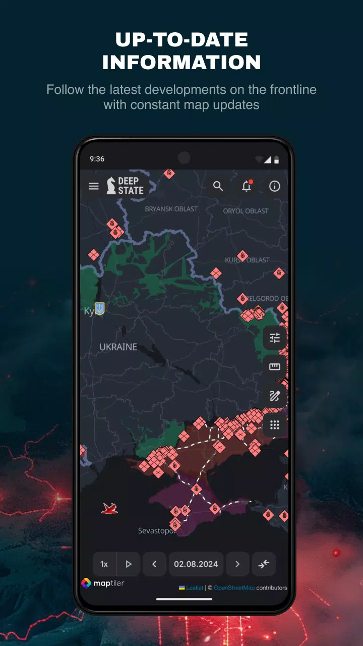
One of the standout features of DeepStateMap.Live is its data caching capability, ensuring that users have access to the latest information even in areas with limited internet connectivity. The map uses a variety of symbols to clearly delineate different zones:
- Territory liberated from occupation within the last two weeks
- Liberated territory
- Territory requiring further clarification
- Territory under Russian occupation
- Occupied Crimea and ORDLO regions
- Transnistria territory
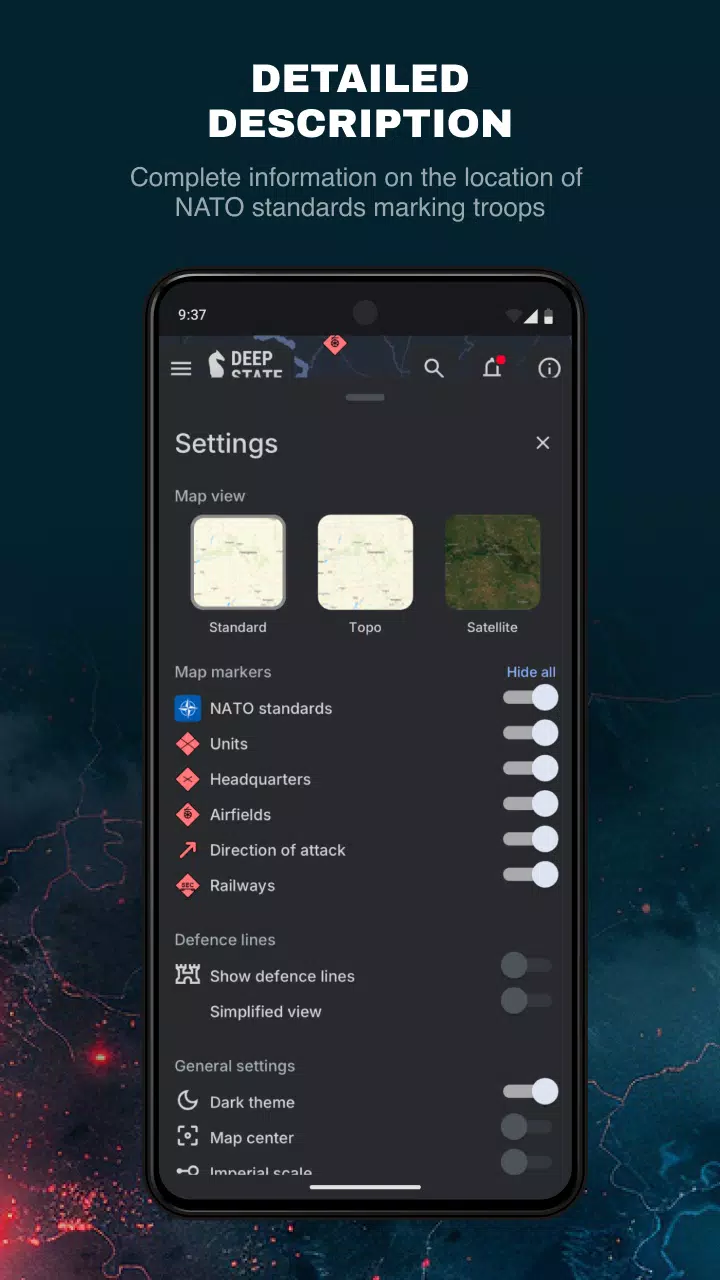
- Russian military units (referred to as "rashists units")
- Russian headquarters
- Russian airfields
- Russian naval fleet
- Directions of Russian military advances
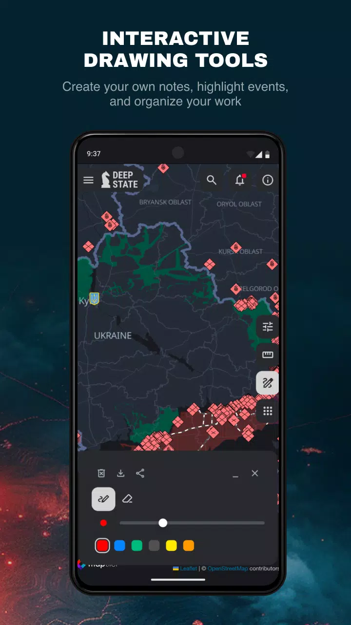
The map divides the territory into distinct zones, each color-coded for easy identification, and marks the precise locations of Russian units and airfields. In addition to the mapping features, DeepStateMap.Live offers a comprehensive news feed to keep users updated on the latest events. Users can also measure distances between different points on the map, enhancing the tool's utility for strategic analysis.
For those interested in more detailed military insights, the platform allows for the display of fire points using data from the NASA Firms system, enabling users to correlate these with the front lines. Furthermore, a specialized mode allows users to calculate the effective range of various artillery systems such as HIMARS, M777, CAESAR, and more, across the entire front line.
What's New in Version 2.0.3
Last updated on Aug 13, 2024
DeepStateMap.Live's latest update, version 2.0.3, includes minor bug fixes and performance enhancements. Ensure you install or update to the newest version to experience these improvements!