 Download
Stay ahead of severe weather with Zoom Earth, the ultimate interactive weather map of the world and a real-time hurricane tracker. With a suite of advanced features including satellite imagery, rain radar, weather forecast maps, hurricane tracking, wildfire tracking, and customizable options, Zoom Earth is your go-to tool for monitoring hurricanes, typhoons, and tropical cyclones in real-time.
Key Features of Zoom Earth
Satellite Imagery: Experience the world's weather with near real-time satellite imagery sourced from NOAA GOES, JMA Himawari, EUMETSAT Meteosat, and NASA polar-orbiting satellites Aqua and Terra. This feature ensures you have the most current view of global weather patterns.
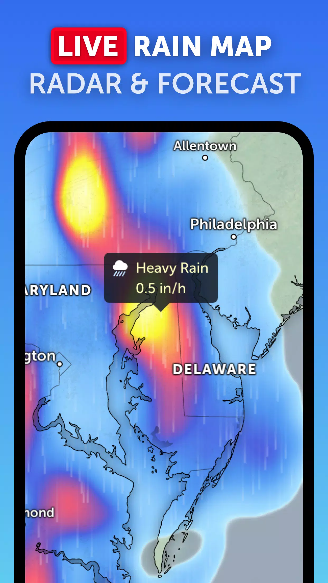
Rain Radar: Get ahead of the storm with our detailed weather radar map. It displays rain and snow as detected by ground-based Doppler radar in real-time, providing you with up-to-the-minute precipitation data.
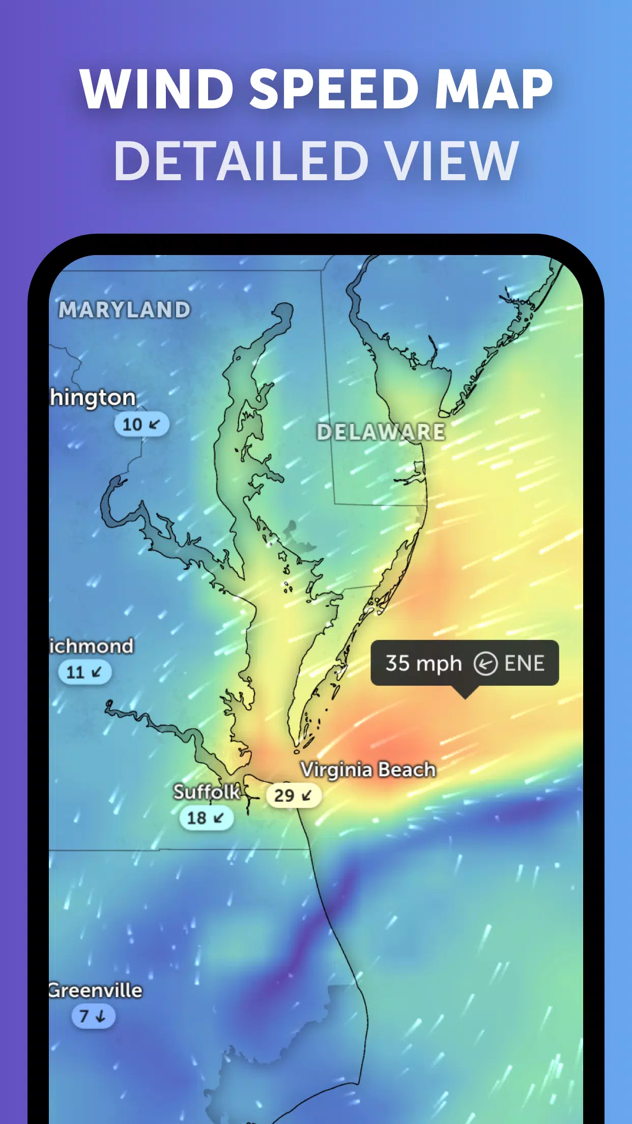
Weather Forecast Maps: Dive into interactive visualizations of the weather with our visually stunning global forecast maps. These maps include detailed forecasts for precipitation, wind speed and gusts, temperature, "feels like" temperature, relative humidity, dew point, and atmospheric pressure.
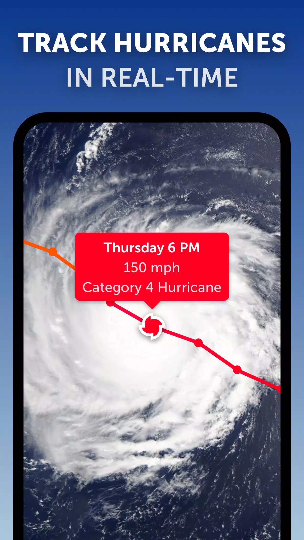
Hurricane Tracking: Track hurricanes from their initial development through to category 5 status in real-time. Our top-tier tropical tracking system leverages the latest data from NHC, JTWC, NRL, and IBTrACS to keep you informed about the path and intensity of these powerful storms.
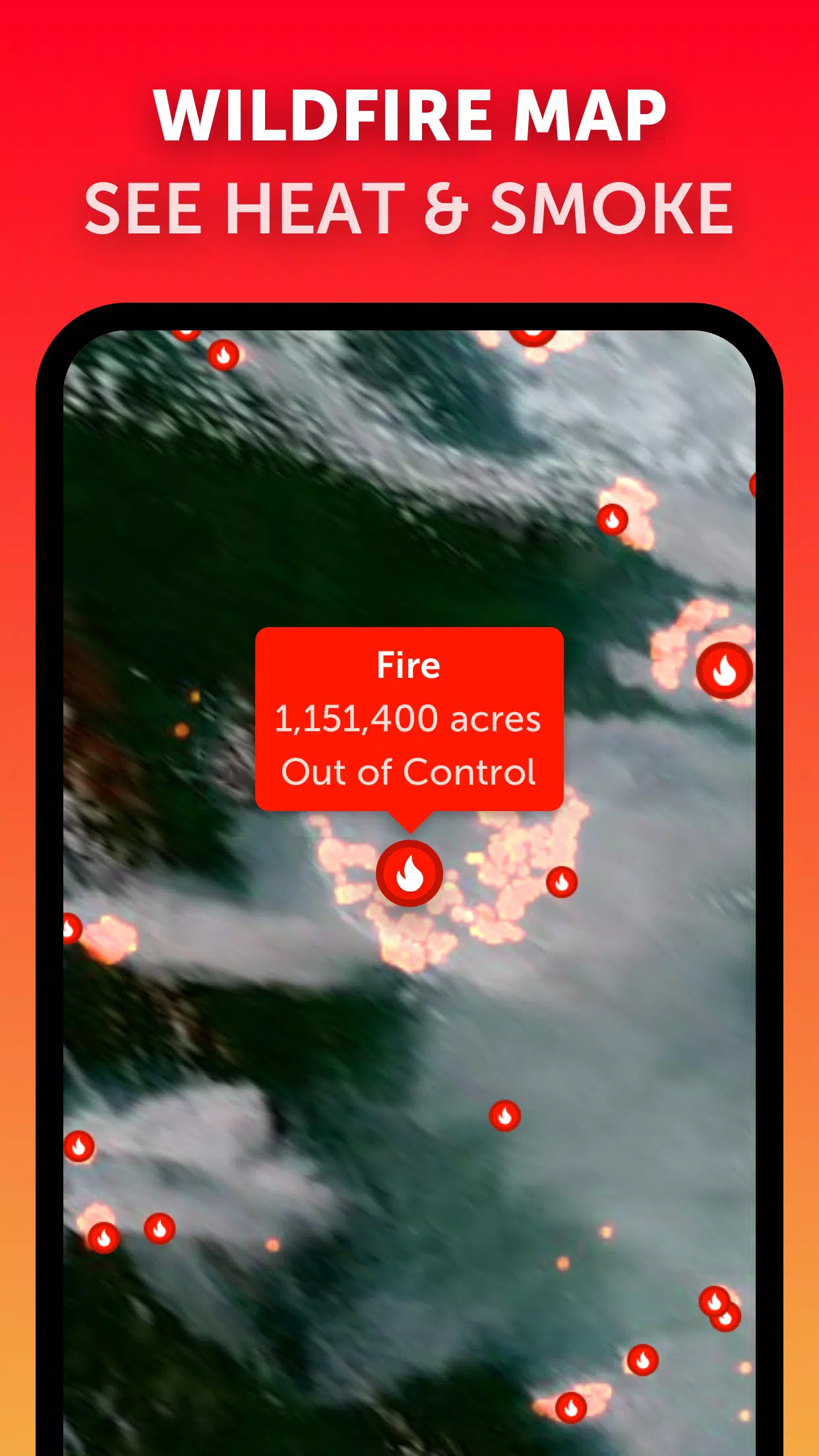
Wildfire Tracking: Keep an eye on wildfires with our active fires and heat spots overlay. This feature displays points of very high temperature detected by satellite, updated daily with data from NASA FIRMS, ensuring you're aware of fire risks in real-time.
Customization: Tailor your experience with Zoom Earth by adjusting temperature units, wind units, time zone, animation styles, and more through our comprehensive settings, making the app adaptable to your personal preferences.
What's New in Zoom Earth Version 3.1
Last updated on Sep 19, 2024
- Streamlined the interface for viewing multiple tropical systems, reducing clutter for a clearer view.
- Implemented separate alerts for Atlantic and Eastern Pacific systems, ensuring you receive timely and relevant notifications.
- Enhanced map labels for improved readability and navigation.
Zoom Earth not only helps you track hurricanes, typhoons, and tropical cyclones in real-time but also enhances your overall weather monitoring experience with its detailed and customizable features. Whether you're a weather enthusiast or need to stay informed for safety reasons, Zoom Earth is the tool you need.