 Download
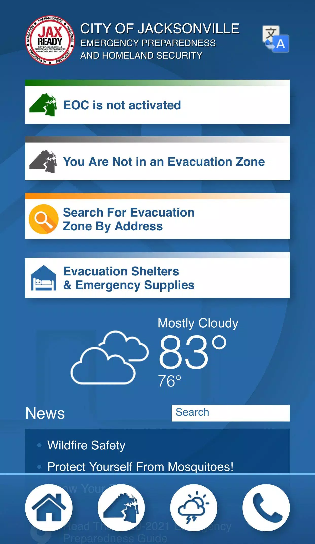
Are you ready? JaxReady, brought to you by the Emergency Preparedness Division and Information Technologies Division of the City of Jacksonville, Florida, is your go-to resource for monitoring weather threats and planning for evacuation during natural disasters. JaxReady equips you with real-time information, including current threat levels, detailed weather reports, and wildfire updates, alongside up-to-the-minute news feeds crucial for emergency preparedness and evacuation planning.
Features
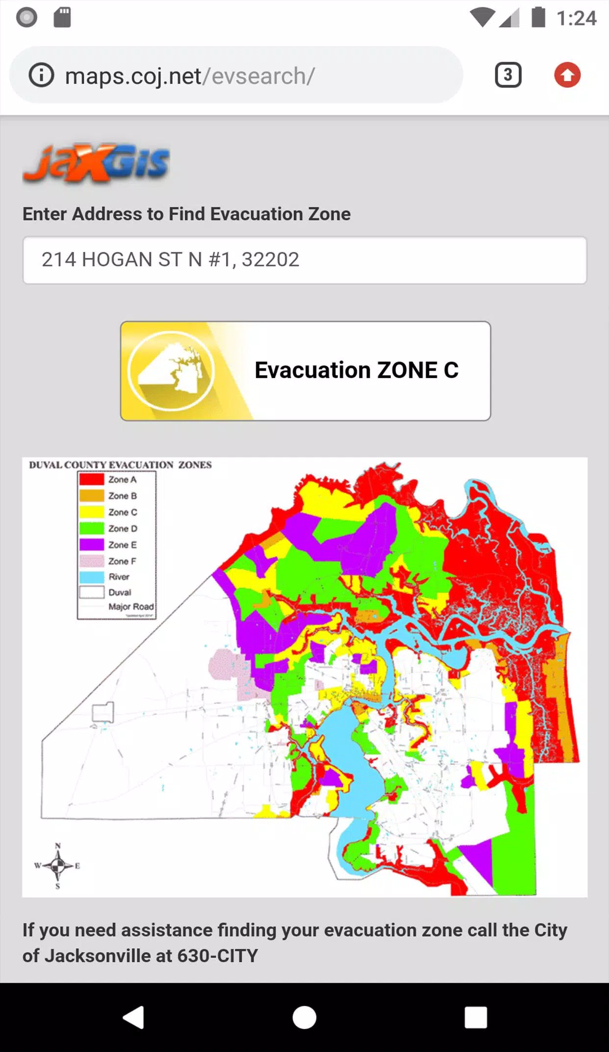
GPS Functionality: Easily locate your designated Evacuation Zone with precise GPS technology.
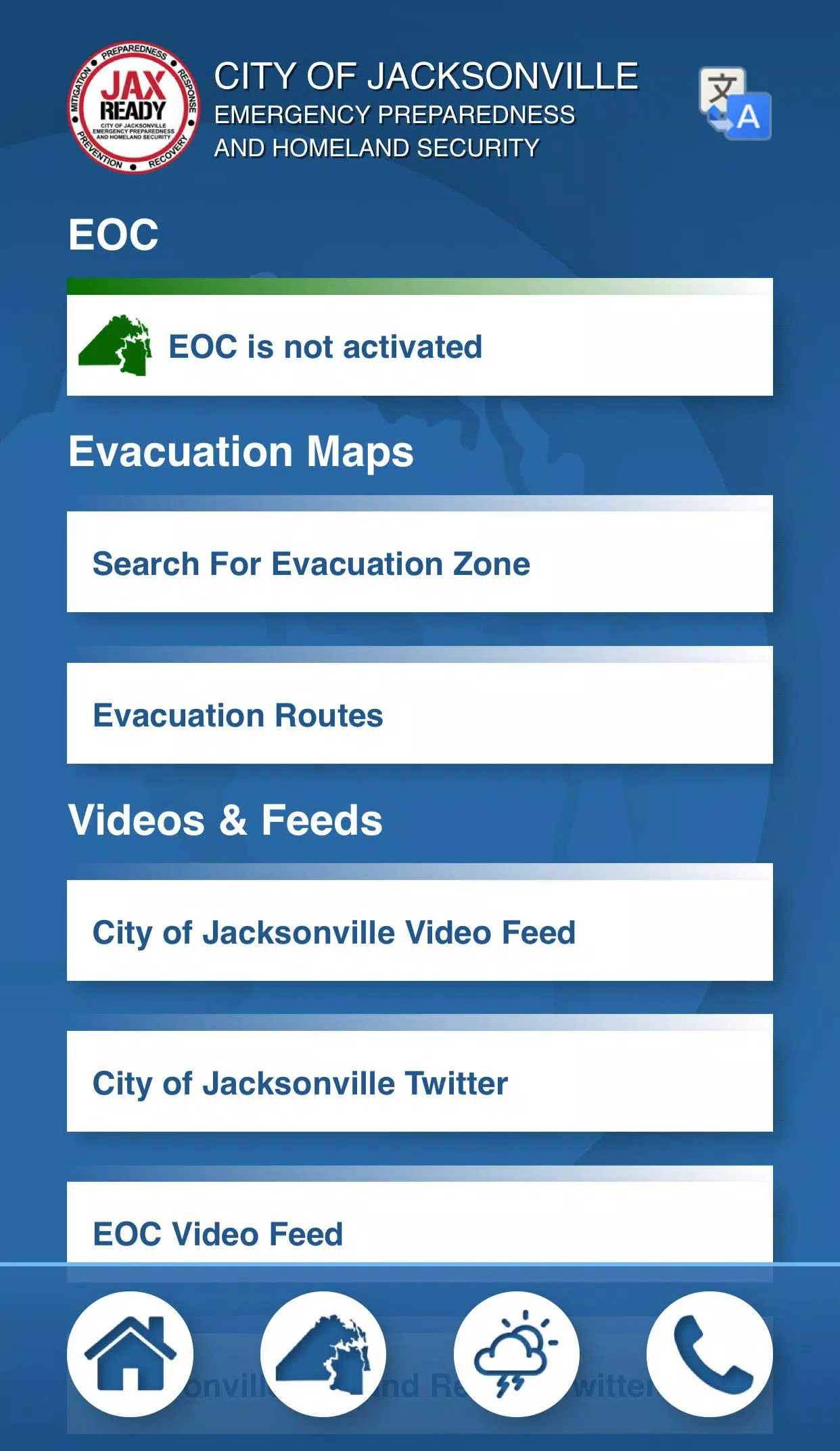
Real-Time Alerts: Stay informed with the current Emergency Operations Center (EOC) Activation Level, Weather Threat Level, and Fire Danger Index, all tailored to your specific geolocation.
Special Needs Support: Access links to register for special needs assistance, ensuring those with medical requirements are well-prepared for evacuation.
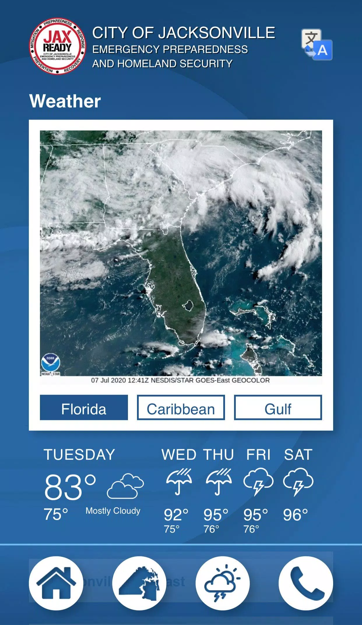
Comprehensive News: Get the latest on weather and fire incidents through dedicated news feeds.
Interactive Maps: Utilize detailed maps showing weather patterns, wildfire spread, and drought indices to stay ahead of potential dangers.
With JaxReady, you're not just preparing for emergencies; you're staying one step ahead.