 Download
City routes, live traffic, transit routes, parking, offline map and navigation.
We are excited to announce the update of 2GIS, as it has become challenging to showcase all the detailed information about cities and companies within the current version of the app. In the new 2GIS, we have revamped the design, introduced a new search functionality, enhanced city updates, and seamlessly integrated favorites with 2gis.ru.
Services, Addresses, and Companies
2GIS is your go-to source for finding which service provider operates in your building, locating your nearest district hospital, or finding the closest post office. It helps you select cafes or service centers based on reviews and photos, and provides essential details like opening hours and contact numbers.
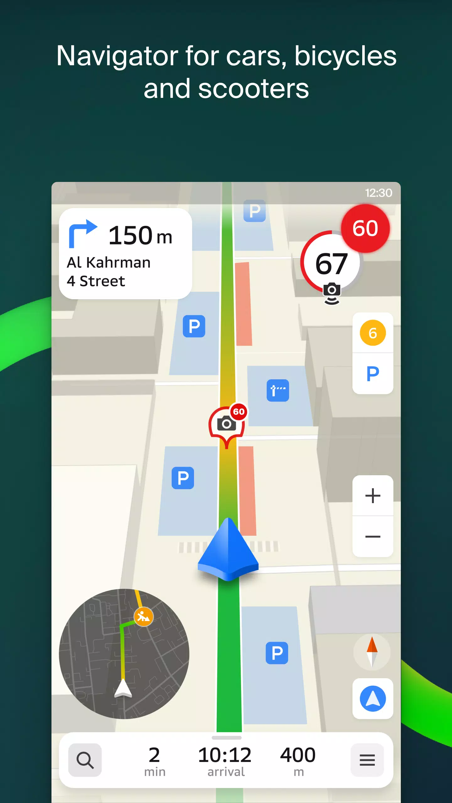
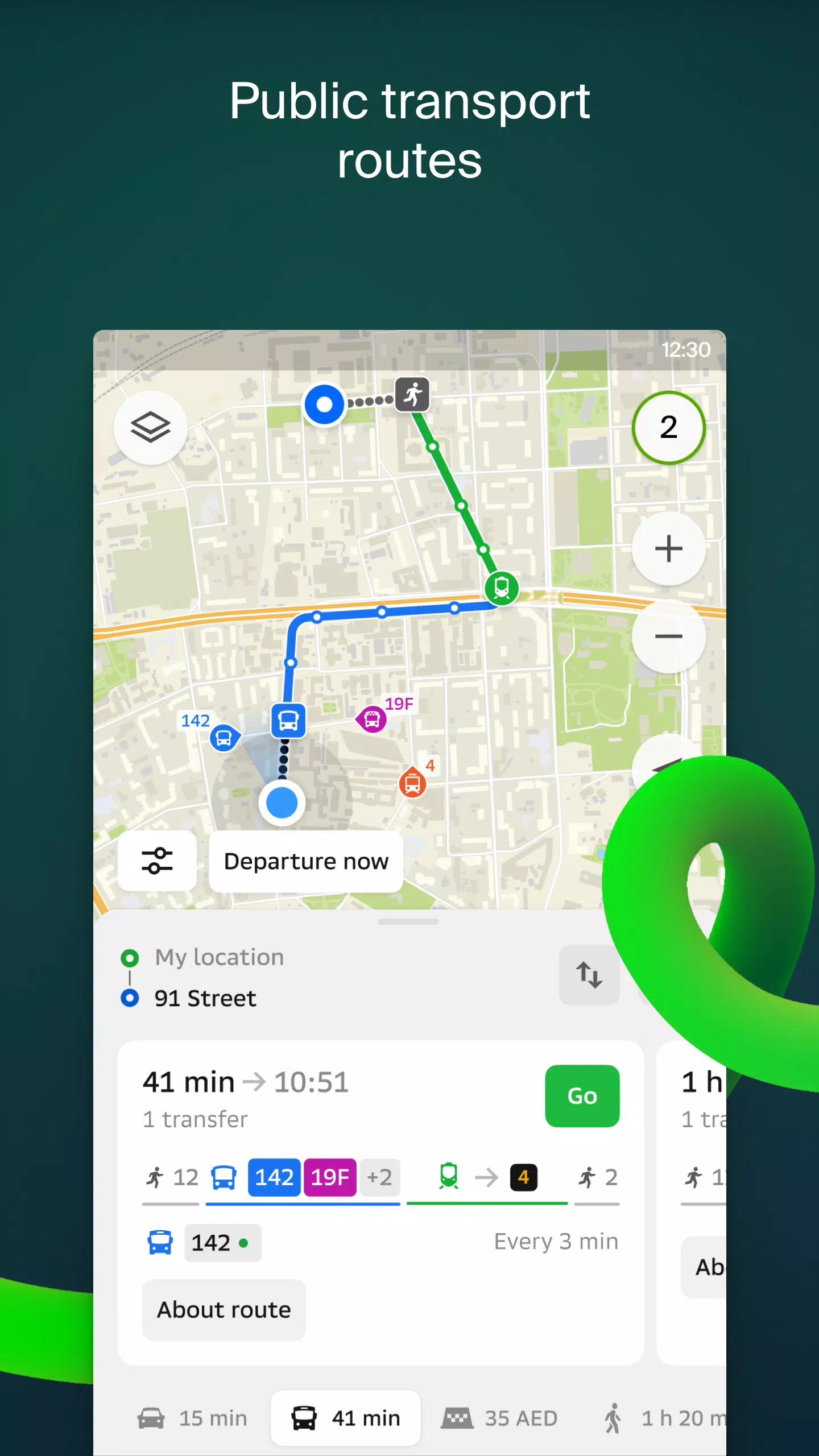
Transport and Navigation
For drivers, 2GIS offers real-time voice-guided navigation that considers traffic conditions and roadblocks, dynamically updating your route if you stray off course. For public transport users, it calculates optimal routes using buses, metro, trains, cable cars, and river trams.
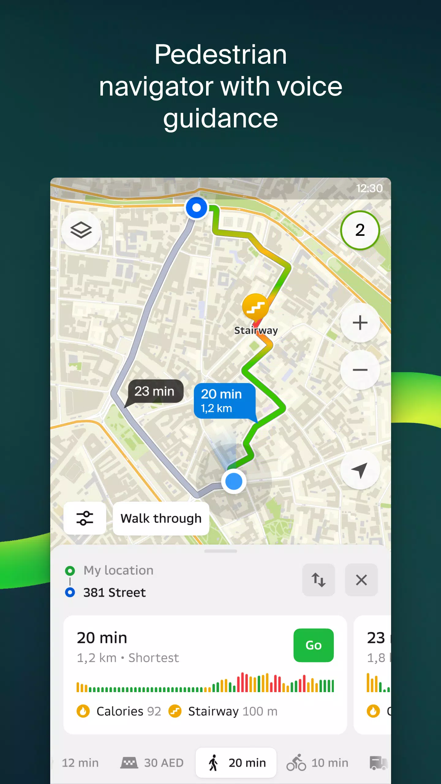
Walking Routes
Our pedestrian navigation system guides you on foot, working seamlessly in the background with voice instructions to ensure you reach your destination effortlessly.
Friends on the Map
With 2GIS, you can now track the real-time location of friends and family on the map. You control who can see your location and who you can view, with visibility settings easily managed within the app.
Building Entrances
Avoid the hassle of finding the right entrance to a business center with 2GIS. The app provides access information for 2.5 million companies, guiding you directly to the door, whether you're arriving by public transport or car.
Plans of Shopping Centers
Navigate inside shopping centers with ease using 2GIS. It displays a comprehensive layout, from shops and cafes to ATMs and restrooms, allowing you to plan your visit in advance and save time.
2GIS Beta Notifications Companion App for Smart Watches
Experience the convenience of the 2GIS beta Notifications companion app on your Wear OS smart watch. Navigate routes on foot, by bike, or using public transport directly from the main 2GIS beta app. View maps, receive maneuver hints, and feel vibration alerts when approaching turns or your destination bus stop. The companion app automatically launches when you start navigation on your phone and is compatible with Wear OS 3.0 and later versions.
As a beta tester, you'll receive the latest updates as we address bugs and errors, playing a crucial role in shaping the future of 2GIS, which will soon be used by millions. You don't need to uninstall the original version; the beta version runs concurrently, allowing you to switch between them effortlessly.
Support: [email protected]
What's New in the Latest Version 6.44.1.559.3
Last updated on Oct 19, 2024
We're thrilled to introduce these beautiful, crisp updates for you:
— Enhanced road visuals on the main map and during route searches, now displaying wider, more realistic roads. — Introducing Chats for Friends! Now you can communicate directly within the app without leaving the map. — Added notifications for when a friend is nearby, with the option to disable this feature in settings. — Just in time for ski season, we've added ski lift statuses on slopes to help you plan your day on the mountain. — For public transport routes that involve walking, we now calculate the walking portion in steps for a more precise journey plan.