 Download
Super Terrain: Your Comprehensive Mapping and Navigation App
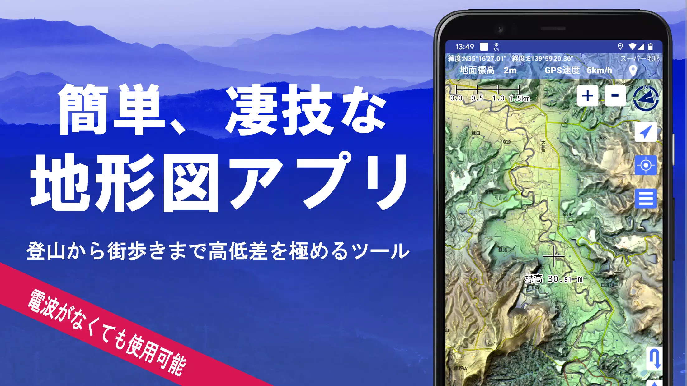
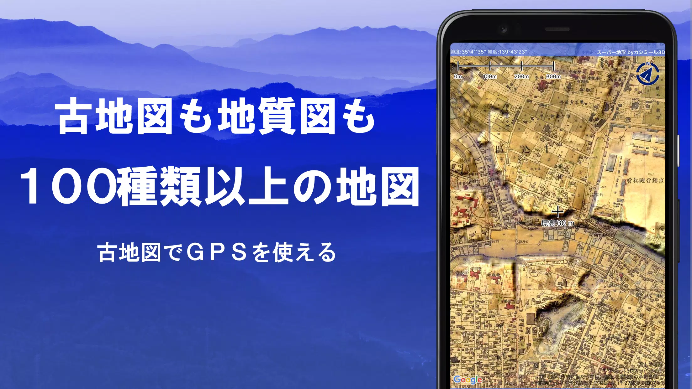
Super Terrain is a powerful mapping application boasting over 100 map types, including those from the Geospatial Information Authority of Japan (GSI). It's ideal for diverse activities, from urban exploration to challenging mountain climbs, maximizing the visualization of elevation changes. A recipient of the 2018 Japan Cartographic Society Award, Super Terrain offers unparalleled detail and functionality.
Key Features:
-
Extensive Map Library: Access over 100 map types, combining GSI maps (topographic, geological, historical), hazard maps, and Super Terrain's unique high-resolution topographic data. Aerial photography is available, though coverage varies by age. A 5-day free trial of Super Terrain data is included.
-
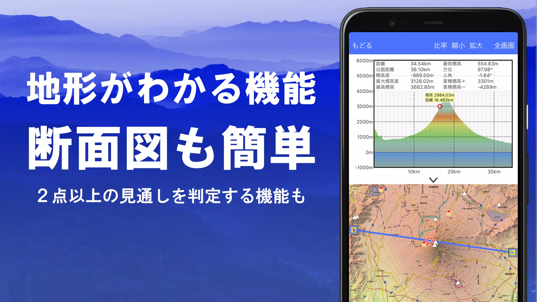
Cross-Section and Visibility Analysis: Easily create cross-sectional views from any map point, incorporating building data where available. The app’s visibility calculation accounts for Earth’s curvature and atmospheric conditions, useful for route planning, communication analysis, and terrain understanding.
-
Customizable Elevation Palette: Personalize your map experience with a fully customizable elevation palette, adjusting colors and gradients in 1cm increments.
-
360° Panoramic Views: Enjoy stunning 360° panoramic views linked to your device's compass, including mountain identification, sun and moon positions (including moon phases), and GPS point locations. This functionality extends to international locations.
-
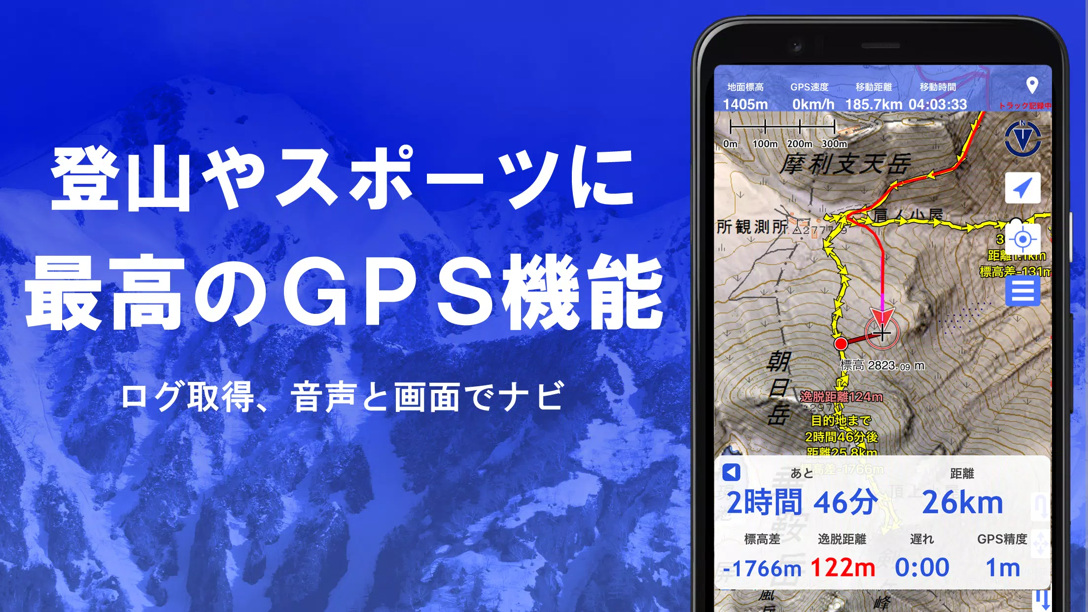
Robust GPS Functionality: Record high-precision tracks (GPX import/export and editing supported), utilize audio GPS navigation (Track Navi) with off-track alerts, and set point alarms. View track summaries with detailed parameters (elevation gain, speed, time), and associate photos with specific points. Data can be sent to NaviCon.
-
Offline Capabilities: Download maps in bulk for offline use, ensuring seamless navigation even in areas without cellular or Wi-Fi connectivity. A caching function further enhances offline access.
-
Data Management & Editing: Organize GPS data (points, routes, tracks) using a user-friendly folder system. Create, edit, and import/export GPX files. Directly create tracks on the map.
-
GIS Data Support: Import, display, and edit GeoJSON files (points, lines, polygons), and create new shapes.
-
Output Options: Print maps at custom scales or export as PDFs.
-
Additional Features: Includes a map history function, custom map compatibility (Kashmir 3D map cutter compatible), dark theme support, and a backup/restore function (with Google Drive integration).
Pricing and In-App Purchases:
A yearly subscription of 780 yen unlocks premium features such as Super Terrain data, advanced GPS functions, and cross-sectional views. It also increases the number of place name search results. A 5-day free trial is available upon installation. Automatic renewal can be managed through Google Play. Prices are subject to change.
Important Notes:
- Continuous GPS use will drain battery life. Consider carrying a spare battery, especially during extended outdoor activities.
- Some smartphones may experience track recording interruptions due to power-saving features.
- See the manual for detailed instructions: https://www.kashmir3d.com/online/superdemapp/superdem_navi.pdf
Super Terrain is a comprehensive and versatile mapping application, perfect for both casual explorers and serious outdoor adventurers.